|
We start with Day one
|
|
|
|
|
|
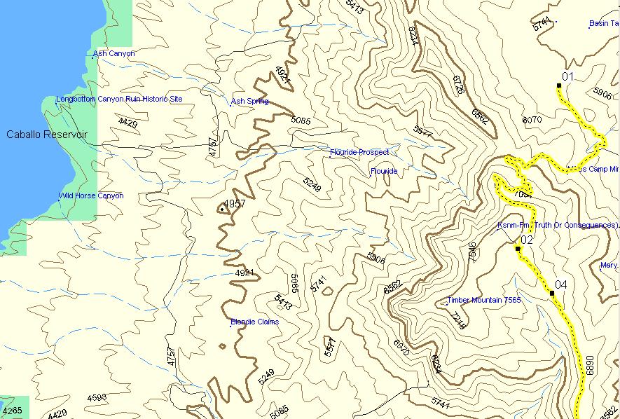
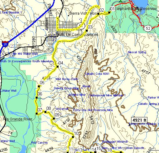
Day 1There are some mountains east of T or C (Truth or Consequences) New Mexico. The GPS shows a trail that would take us up a gap (Palomas Gap), and then run along the ridge of the Caballo Mts. Sounds good to me, get out the map and GPS and plot a route.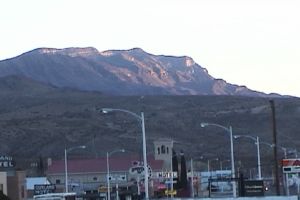
Any time you go into a remote area you should call a reliable friend or family member and leave your expected route and when you report back, the reason is if you break down or get injured you want somebody to go looking for your body. I used to check in with the forest service until I learned that the forest service will NOT go looking for you until a family member calls the forest service to say you are missing!
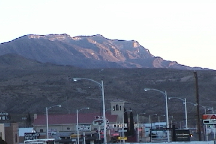
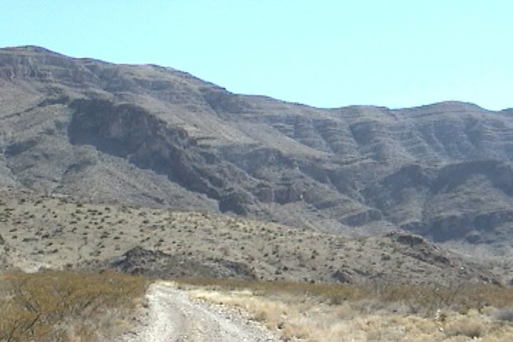
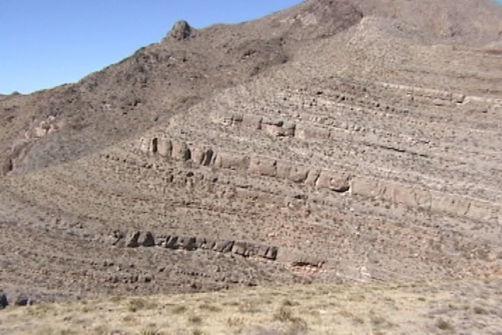
I would not call these true mountains the map shows the east side of the mountains to be a gentle slope up and the west side, pretty much vertical cliff. As if the crust were tilted up.
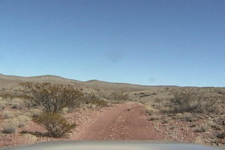
From T or C Head east on Rt 51 Just after crossing over the Rio Grande its a hard right turn onto dirt. The graded dirt road runs between the Caballo Mtns and the Rio Grande.
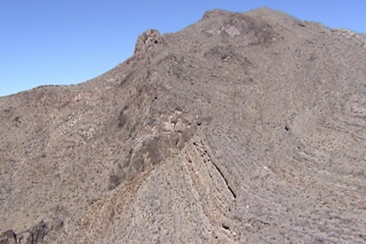
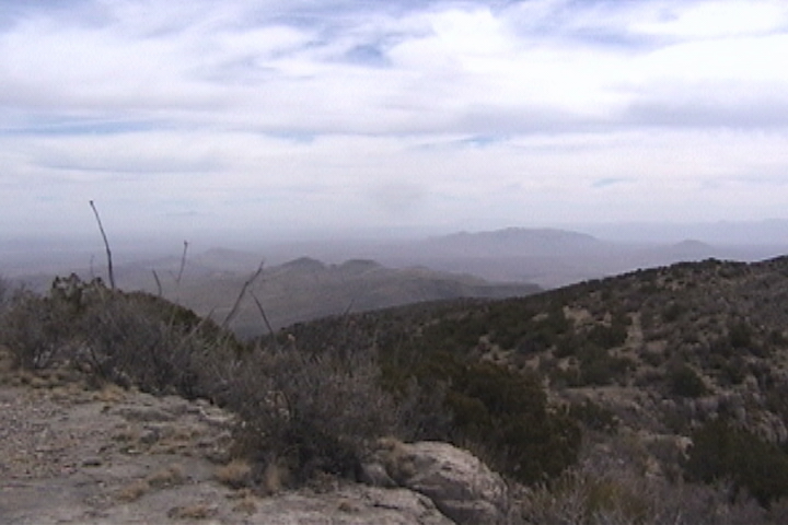
When you look up to the towering mountains the top 1/3 is a semi cliffy the bottom 2/3 are rubble, 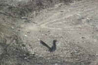 the tallest peak is 8091 ft. the tallest peak is 8091 ft.
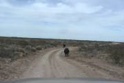
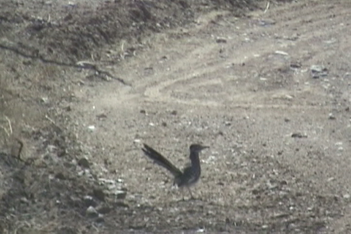
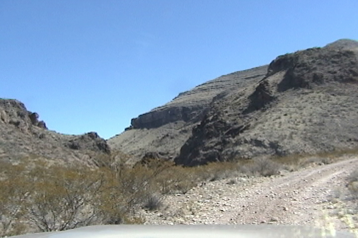
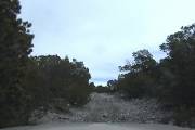
We got to see a rare sight, a Roadrunner! In all my travels to the Southwest, the last time I saw a Roadrunner was in 1966! For the s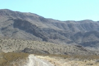 ize of the bird (the body is about the size of a large robin) they have long tail feathers, a long neck and a plume on top of their head. The graded road stops at a cattle gate "if the gate is open leave it open, if the gate is closed close it after you go through, IF the gate has a NO TRESPASSING sign TURN AROUND simple words to live by. The area is littered with roads stay on the well used one. After about 7 miles to ize of the bird (the body is about the size of a large robin) they have long tail feathers, a long neck and a plume on top of their head. The graded road stops at a cattle gate "if the gate is open leave it open, if the gate is closed close it after you go through, IF the gate has a NO TRESPASSING sign TURN AROUND simple words to live by. The area is littered with roads stay on the well used one. After about 7 miles to  your south east, you will see a gap (Palomas Gap) about 2 miles away, turn left off of the well traveled road, while not as well traveled, this is definitely a road that's been used. You will see a road climbing the wall on the north side of the gap, this is not our road, our road climbs the south side of the pass. your south east, you will see a gap (Palomas Gap) about 2 miles away, turn left off of the well traveled road, while not as well traveled, this is definitely a road that's been used. You will see a road climbing the wall on the north side of the gap, this is not our road, our road climbs the south side of the pass.
As you start to head up (at the base of the gap you're altitude is about 4500 feet and the Rio Grand River is about 4300 ft.) the road you have a great view of the road on the north side of the pass which shortly ends in a dead-end, you can also see the bottom of the pass while that road has had quite a bit of traffic in it, it quickly dead-ends at a waterfall. You twist and turn steadily gaining altitude on a road that has been carved out of the near vertical wall of the Gap.
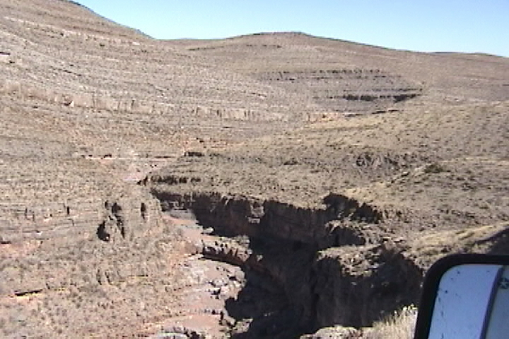
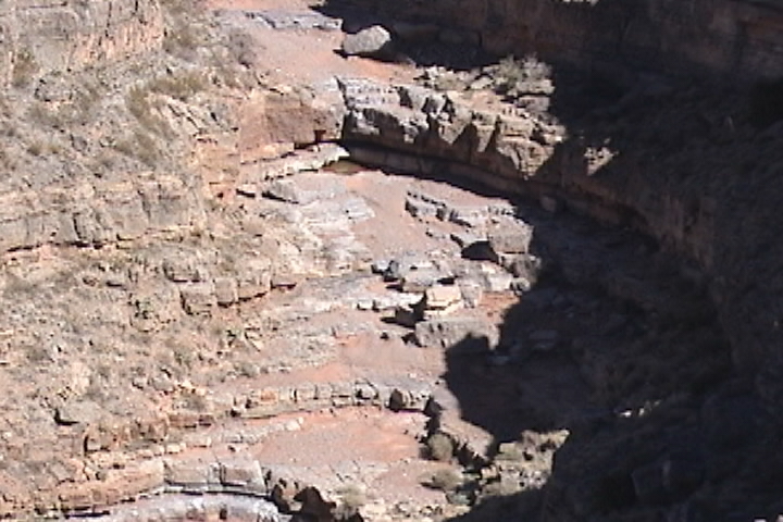
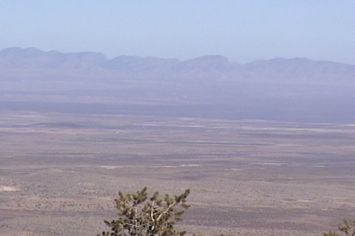
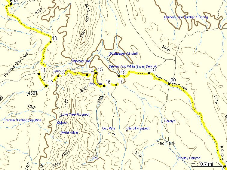
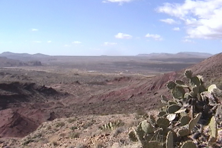
 Behind you on some of the turns you get a good view of the Rio Grande Valley. A wide ribbon, of lush green in an otherwise reddish brown landscape. Depending on how full the Caballo reservoir is, you may just see the northern end of it. The Palomas gap has a dry stream Behind you on some of the turns you get a good view of the Rio Grande Valley. A wide ribbon, of lush green in an otherwise reddish brown landscape. Depending on how full the Caballo reservoir is, you may just see the northern end of it. The Palomas gap has a dry stream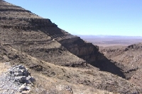 running through it, I would love to be here after a rain and watched the dry stream, alive with churning and boiling water. Unlike streams in the east of the US. streams out West tend to lose altitude by waterfall, usually separated by sandy bottoms with rocks strewn about. Now I'm not saying that they are large waterfalls, the largest one Ive seen running through it, I would love to be here after a rain and watched the dry stream, alive with churning and boiling water. Unlike streams in the east of the US. streams out West tend to lose altitude by waterfall, usually separated by sandy bottoms with rocks strewn about. Now I'm not saying that they are large waterfalls, the largest one Ive seen  in this stream may be as high as 20 feet. The size of the waterfall depends on how thick of supplementary layer is that the water is falling over. We stopped and had lunch at WP 340 a good camping site with a view of the Palomas stream and Gap. in this stream may be as high as 20 feet. The size of the waterfall depends on how thick of supplementary layer is that the water is falling over. We stopped and had lunch at WP 340 a good camping site with a view of the Palomas stream and Gap.
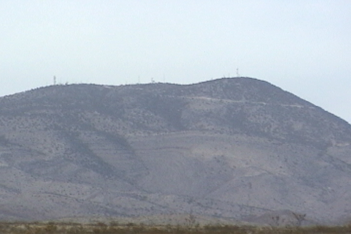
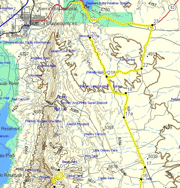
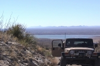
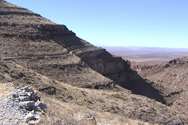
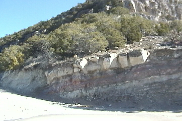
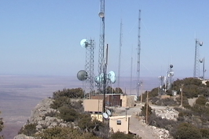
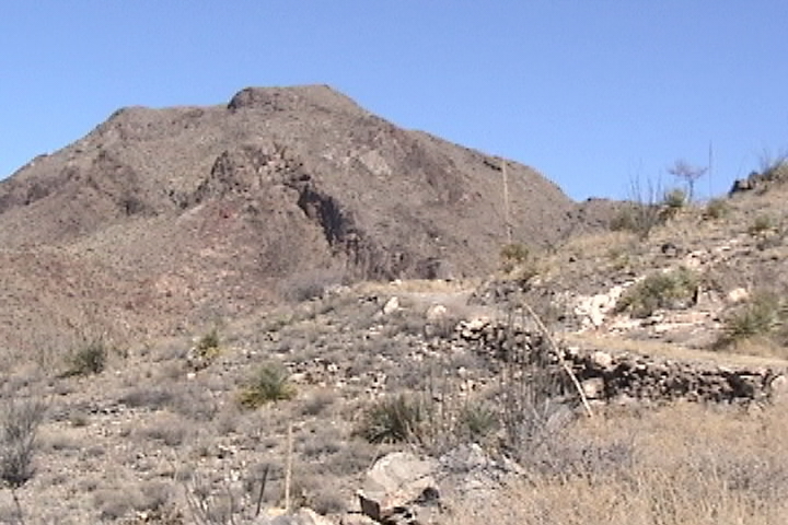
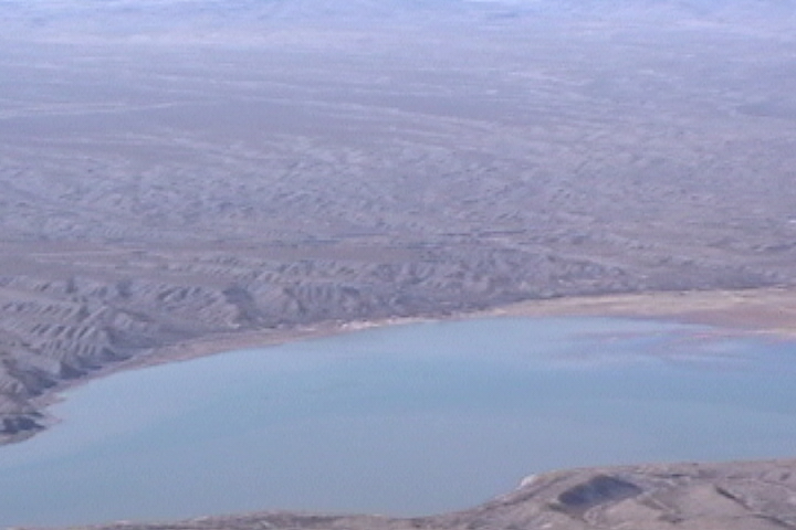
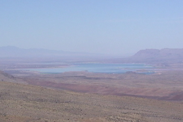
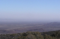
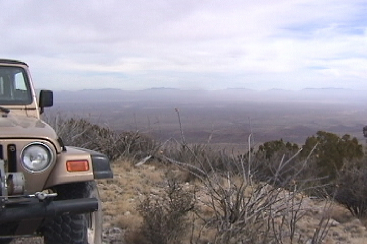
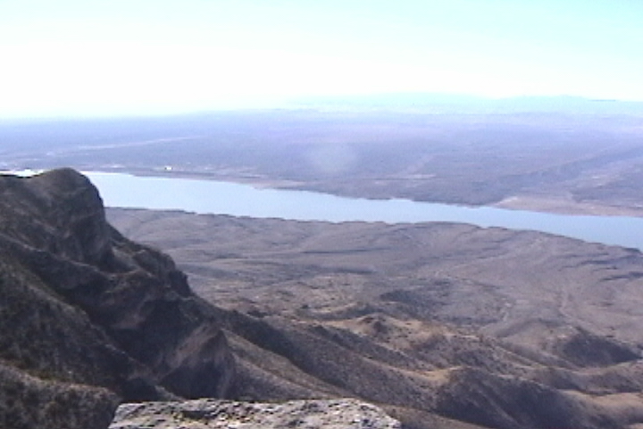
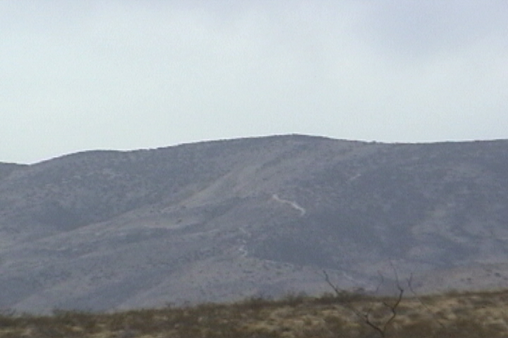
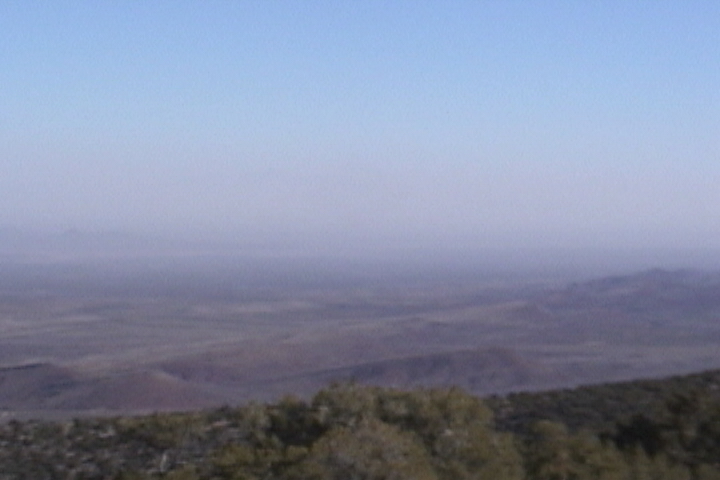
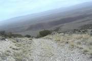
By the time you come out the other side of the gap you're altitude  is about 4900 feet. The ground has changed color from tan sand to finer red colored sand. From here we will eventually be going up to 7500 ft. altitude at the top of Timber Mountain. At waypoint 20 you go strait the map shows that from this waypoint either strait or right will bring you back together at is about 4900 feet. The ground has changed color from tan sand to finer red colored sand. From here we will eventually be going up to 7500 ft. altitude at the top of Timber Mountain. At waypoint 20 you go strait the map shows that from this waypoint either strait or right will bring you back together at  waypoint 21. I went strait. At waypoint 22 I took a right, the map shows that this road goes through, however it ends at somebody's Ranch. Where I met several gentleman, one of whom turned out to be the ranch owner. He said "the road does not go through" I got out my GPS and showed him the road and the offshoot to red tank (on the map). (Out in the west maps show named tanks, now a tank is for water, it may be a metal tank or it may be an earthen berm that holds back Rainwater.) He also claimed no knowledge of "red tank" he did say however that this farm used to belong to the Red family. He suggested as a way around, to go back to waypoint 22 and take a right When you get to the graded road take another right. Graded road? Well that is one of the chances you take when you map a root out using a map, the map says it's a dirt waypoint 21. I went strait. At waypoint 22 I took a right, the map shows that this road goes through, however it ends at somebody's Ranch. Where I met several gentleman, one of whom turned out to be the ranch owner. He said "the road does not go through" I got out my GPS and showed him the road and the offshoot to red tank (on the map). (Out in the west maps show named tanks, now a tank is for water, it may be a metal tank or it may be an earthen berm that holds back Rainwater.) He also claimed no knowledge of "red tank" he did say however that this farm used to belong to the Red family. He suggested as a way around, to go back to waypoint 22 and take a right When you get to the graded road take another right. Graded road? Well that is one of the chances you take when you map a root out using a map, the map says it's a dirt  road you don't know if it's graded, gravel, paved now, passable or even still there! We turn around and follow his road you don't know if it's graded, gravel, paved now, passable or even still there! We turn around and follow his 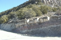 instructions. Ahead of us we can see the mountain (Timber Mt) and the towers on it. I would guess this is the access road for the towers so they can get repair vehicles up the mountain. I would expect the road to be graded. We head up the graded road it shortly turns into a set of switchbacks as the terrain becomes steeper and steeper. At the first switchback is a gate, the gate was locked in the open position (thank you). As we continue up the graded road to our east we were treated to vistas of the valley and beond to the San Andres Mountains in the western edge of the White Sands missile range. The road also cuts through layers of white rock (gypsum). instructions. Ahead of us we can see the mountain (Timber Mt) and the towers on it. I would guess this is the access road for the towers so they can get repair vehicles up the mountain. I would expect the road to be graded. We head up the graded road it shortly turns into a set of switchbacks as the terrain becomes steeper and steeper. At the first switchback is a gate, the gate was locked in the open position (thank you). As we continue up the graded road to our east we were treated to vistas of the valley and beond to the San Andres Mountains in the western edge of the White Sands missile range. The road also cuts through layers of white rock (gypsum). 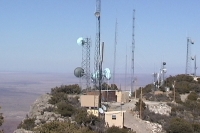 When rain dissolves this rock it seeps into the ground and leaches out. When the water evaporates from the solution you end up with white sands, which really isn't sand but gypsum. As we neared the top you could see all kinds of antennas, there had to be 50 or 60 of them. Since there on a precipice overlooking the Valley they did not need to be very tall, I don't think any of them are over 50 feet tall. From the edge of the precipice we had a great view of the two lakes Elephant Butte reser When rain dissolves this rock it seeps into the ground and leaches out. When the water evaporates from the solution you end up with white sands, which really isn't sand but gypsum. As we neared the top you could see all kinds of antennas, there had to be 50 or 60 of them. Since there on a precipice overlooking the Valley they did not need to be very tall, I don't think any of them are over 50 feet tall. From the edge of the precipice we had a great view of the two lakes Elephant Butte reser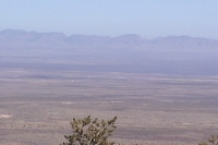 voir to the north and Caballo reservoir just west of us. Both of these lakes were strikingly blue, in part because the surrounding area had a red tinge to the earth. A mineral (I forget witch mineral it is) is responsible for turning the lakes such a rich blue color. The shade of blue depends on the size of the crystals in the water. You also had a great view of the San Andres Mtns. I would love to go explore in those Mountains. They have 7 to 8,000 ft peaks and rugged. But alas they are in the White Sands Missile Range and closed to the public. Hey, wasnt the government supposed to give back that land to the owners after 25 years? Because of all the radio transmitters the air seemed to be alive, you could actually hear humming and sizzling. It was getting late and Sue did not like all the EM flying around (and I definitely felt fuzzy), so we headed down to a lower altitude to make camp. voir to the north and Caballo reservoir just west of us. Both of these lakes were strikingly blue, in part because the surrounding area had a red tinge to the earth. A mineral (I forget witch mineral it is) is responsible for turning the lakes such a rich blue color. The shade of blue depends on the size of the crystals in the water. You also had a great view of the San Andres Mtns. I would love to go explore in those Mountains. They have 7 to 8,000 ft peaks and rugged. But alas they are in the White Sands Missile Range and closed to the public. Hey, wasnt the government supposed to give back that land to the owners after 25 years? Because of all the radio transmitters the air seemed to be alive, you could actually hear humming and sizzling. It was getting late and Sue did not like all the EM flying around (and I definitely felt fuzzy), so we headed down to a lower altitude to make camp.
The map showed that we had crossed our road that continued along the ridge, I did not see it on the way up so I was looking hard for it on the way down. I found a road to our left, I figured this must be where we crossed the road. But there was no road on the right. However a couple of hundred feet further down the GPS beeped. After getting out of the Jeep and looking. I found a road on the right it was hidden on the switchback, Ha I found it! Back in the Jeep I continued to retrace my trip down and look for some place to camp. Just before we had started up the switchbacks I had noticed a road on the right. On the way down we took a left onto the road.
A half-mile later on the back side of a small hill I found a flat spot and we set up camp at Waypoint Camp at 5900 feet.
The shadows from the Caballo Mountains to our West came racing at us. As soon as the sun went away the temperature dropped like a lead balloon! It got so cold and windy that we skipped dinner and were in bed by 6 PM with an outside temperature of 18 degrees!!
Tomorrow we continue down the Caballo Mts ridge rd to Brushy Mt
|
|
|
|


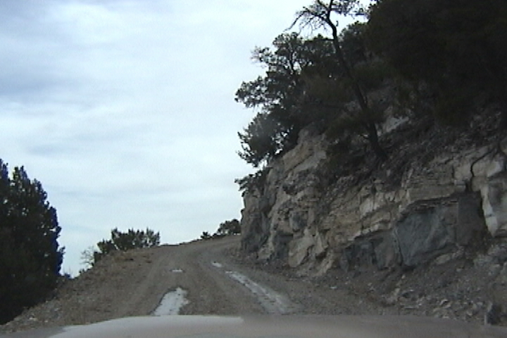

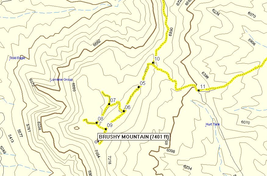
 to be in green. Altitude seems to make all the difference for plant life we started to get into the----- at about 7000 feet. Once we got to Brushy mountain there were a whole bunch of trails, we stay on the main trail which found its way through a small cow pasture every once in a while through the------ trees you could see the remnants of mining.
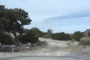
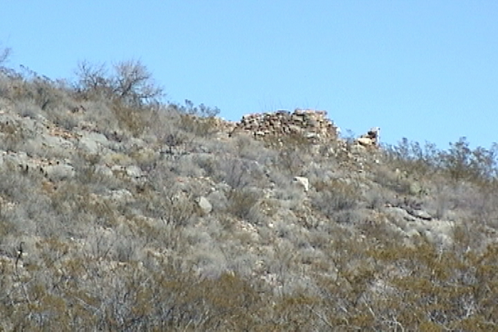
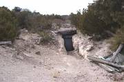 Usually a small hole and a pile of rock, dilapidated shed and tin cans. We did find several that had signs posted on them that gave you the impression, that it was pretty much a certainty, if you got caught messing with the claim it
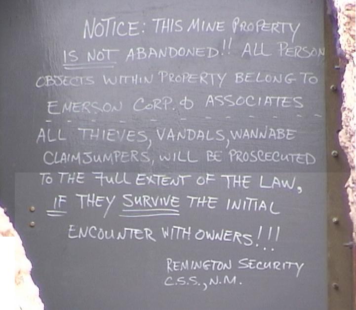
 bit rough with grapefruit sized rocks, you sort of bounced and slid down. You shortly come to a road on the right at waypoint 11 from here on out its graded road. For further down the mountain you go the more sparse and dryer the terrain becomes. Once you're down in the valley that's where you run into cattle. Turn left onto the main road and in a little wile you come to a cattle guard and Lyon Slater Ranch, actually you don't come to it as much as go through it. The Ranch is on the
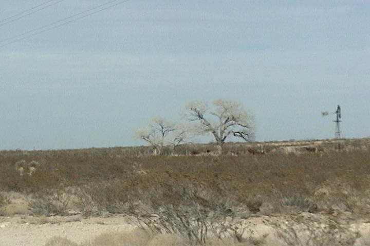
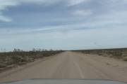 GPS map, this is certainly not the Ponderosa there are two buildings on the right and one on the left, a water tank and several cattle pens. After you go through the Ranch the road becomes a highway and follows along a set of high tension wires. The way I had mapped out our route at waypoint 17a I had intended to go straight. Actually I missed this turn. At the next intersection I turned left and got back on track. This took us off of the graded road and on to a rather poor road that followed along some telephone poles. This road was very rocky and twisty and ended up at a fence and gate with no trespassing signs on the gate. At this point we were only two miles from the paved road and needed to back track three miles to where I had seen a road to the right and the GPS showed that it reconnected with the main dirt road. We reconnected with the main road at waypoint 22. I would suggest you stay on the main road. Once this road dumped us on to Hw 52 we headed back to T. or C..