Gila National Forest 1 Day Trip

Now for most of my trails you can download my GPS track (bread crumb trail) as well as the map of my track. For more info Click Track Info

Click on any picture with a border for a larger view

A one tay trip through Gila NF

We left the Desert View motel at 8:30 AM for our trip through Gila National Forest, temp last night 25 degrees.  We gassed up at Circle K and topped off the spare gas can.  And were off, we're starting the trip at T. or C. which is in the desert, 
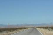
Gila National Forest contains mountains that we will be driving through, with the added altitude I am hoping we will see real trees.  I am also hoping to find some challenging sections to the road that runs through the forest.  However past experience with Rangers and their definition of tough roads leaves me somewhat skeptical when I am told "is definitely a four-wheel-drive road". 

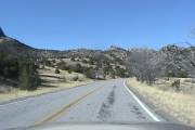
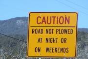
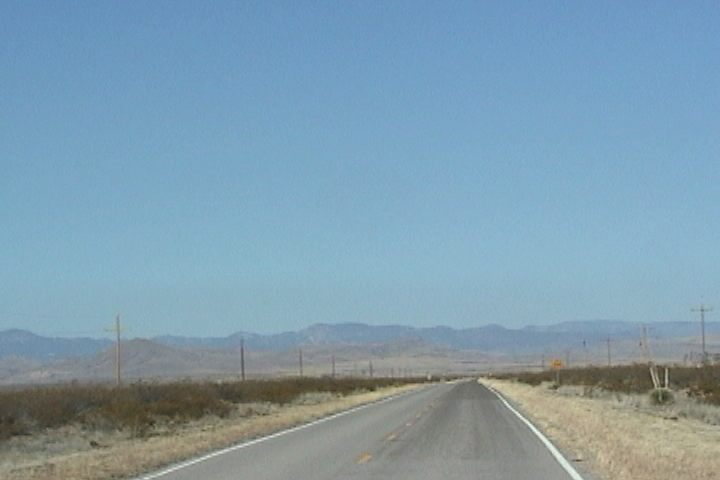
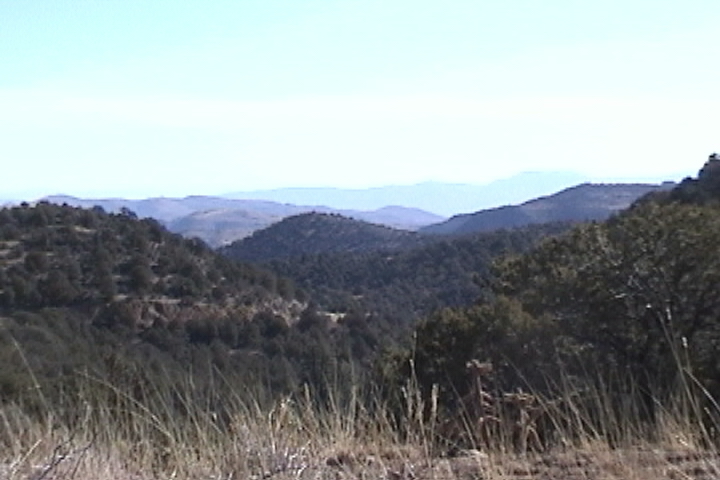
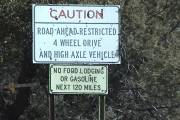
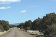
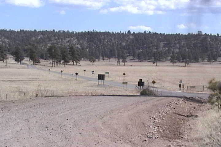
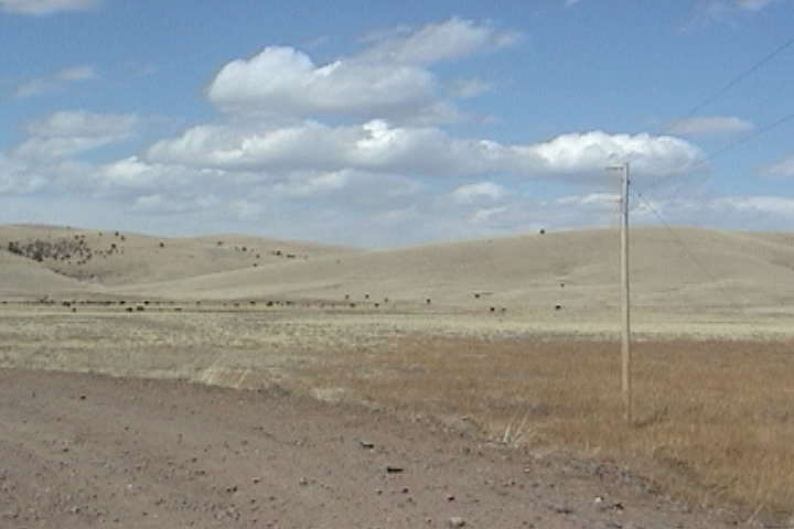
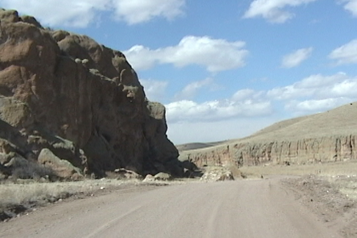
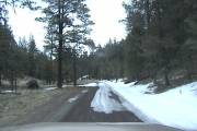
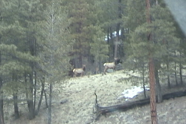
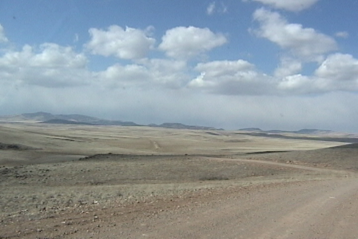
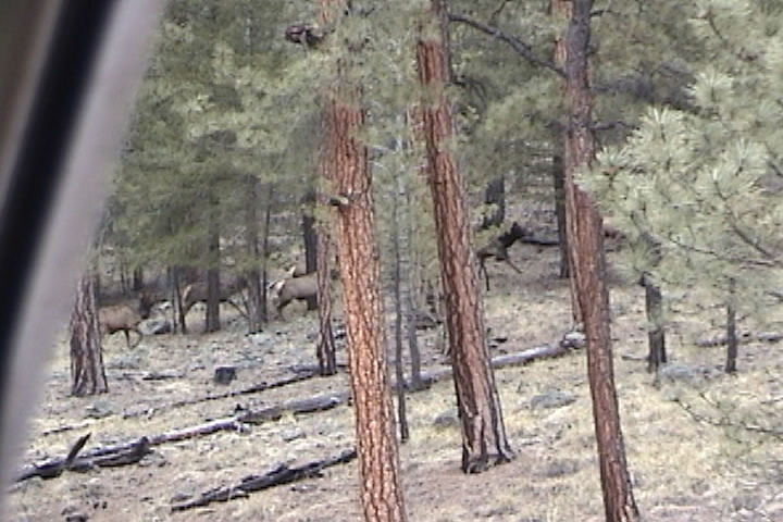
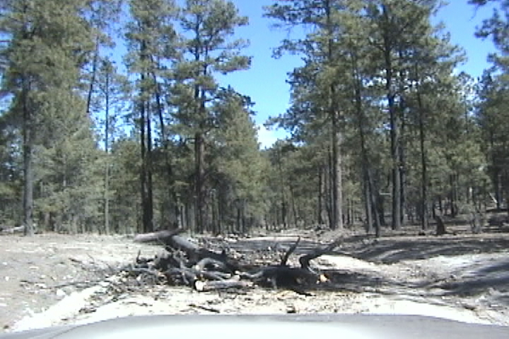
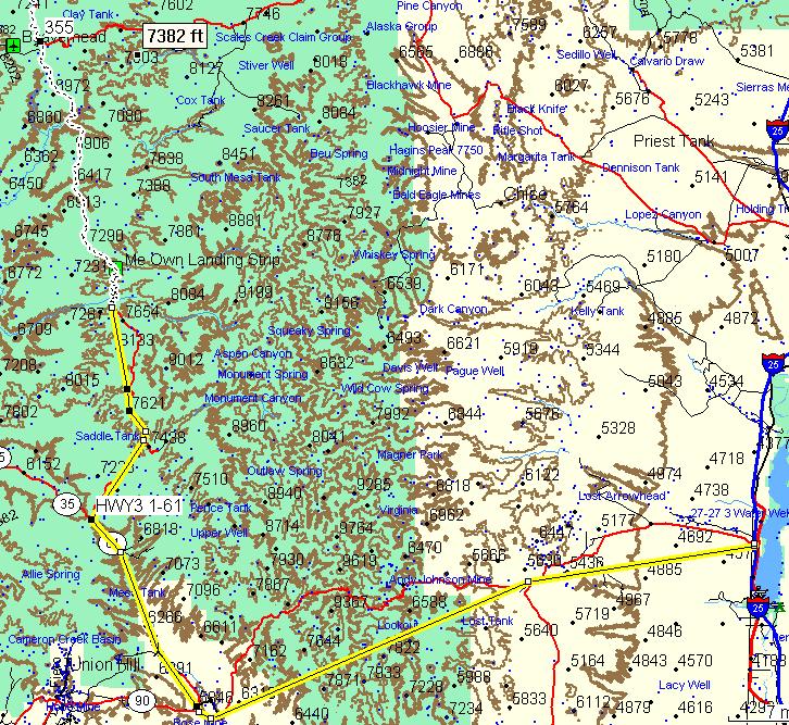
As we head out down the road we take interstate 25 down to the town of Gable where we turn right on Rt 152 the GPS has this as Route 90 toward the town of Hillsboro and 
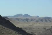
Silver City.  This desert area is hard packed sandy clay with the very sparse grass.  Off in the distance we can see the 
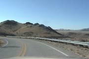
mountains of the Gila National Forest, the hills that we can see are earthen colors which means there's not much vegetation on them.  As we enter the foothills we start to find a spattering of low bushes, and rock.  We also come across a rarity for the Southwest a guard rail on a secondary road!  When you get to the town of San Lorenzo turn right onto Rt 35, hey what you know! the GPS also calls it Route 35.  According to the sign they don't plow this road at night or on weekends, I guess if it snows over the weekend you don't get to work until Monday afternoon.  Don't forget to gas up, the middle of the wilderness area is no place to run out of gas!  We are headed up; at 6700 feet we have 
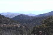
trees!  As our altitude increases the sun becomes harsher as there is less atmosphere for the sun to pass through, fortunately because of a higher altitude there are trees to provide shade.  This is a very windy road and while there are t
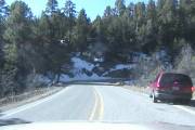
rees, unlike New England you are not driving through a tunnel of trees, there are abundant curves with vistas of green hills and mountains on this road.  As we head up we get high enough to find snow in the shadows.

Our next turn is onto dirt, the map calls it forest road 150 the GPS calls it Route 61.  This road follows along the Continental Divide for several miles.  The sign at the beginning of the road promises an interesting trip "road ahead restricted four-wheel-drive and high clearance vehicles" the second sign just below that "no food lodging for gasoline next 120 miles" now those are the signs I like to see.

Man O man is this road rough, I don't mean the good kind of rough it is so severely washboard that anything over 5 MPH feels like you're in a paint shaker!  I don't get a half-mile down the road before I have to stop and air down, this is a well maintained road, but it's unbelievably washboard the worst I've ever experienced!

Rt 59, Beaver Head Workcenter

At 7236 feet were in among short bushy Pine trees outside temperature 61 degrees and it's extremely windy and has been all day.  After the initial climb the washboard reduces

considerably this is a well graded and traveled road.  By 1:30 PM we're far enough up into the mountains to have tall pine trees and start finding snow on the road (I sure hope we don't run into any "snot"!).  The forest here is a lot more open beneath the trees than back East.  As you head down the other side of the mountains the patches of snow become less frequent, the trees start to thin out now and then replaced by low Juniper trees.  Eventually we come to an area with a lot of high Meadows surrounded by trees and hills.  This means you're approaching Beaver Head workcenter.  This is the base camp for a lot of forest service workers.  Shortly after leaving Beaver Head workcenter we come to an area that really looks like high plains very few bushes lots of golden brown grass.  The road goes through a section that looks an awful lot like parts of CanyonLands National Park.  By that I mean the Needle Districts of CanyonLands, there are a bunch of finger shaped valleys that were made by collapsing salt domes.  This area certainly looks like one of those fingers. A finger shaped valley with sandstone walls on either side.  Ahead we come to a left turn and we leave Route 163 also known as forest service road 150 and turn on to forest road 30 towards Turkey Track.  At Turkey Track we continue on forest service road 30 which the GPS calls route 78.  The road travels through a substantial amount of high plains. At around 7300 feet altitude the sun is warm the wind is cold and there's plenty of it.  Since this is plains the vistas available here, if you enjoy waving grasses are spectacular.  High plains are usually surrounded by the mountaintops and this area is no exception.

Off to our Northwest which is where we're headed we can see some mountaintops, sometimes.  They seem to be shrouded in white fuzz.  I think it's really snow falling on the mountains. Eventually you come to forest road 94 and we turn north toward Apache Creek.  At the far side of the high plains we start to head up into the surrounding mountains, before heading down the other side to Apache Creek.  The road once again has patches of snow on it, I was right, there is a very light snow falling in these mountains.  We come around the corner into a small open field. At the edge of the field mixed in with the trees is a small herd of elk!

Elk!

It’ snowing in them hills.
Oh-oh that’s where we’r going!

On the left was what looked like a park or camping area.  We then crossed over a stream, a stop sign, and pavement, we made it to Apache Creek!   Just across the intersection was the Apache Creek convenience store, a cup of coffee a quick rest stop and we're good to go.  We asked the lady behind the counter about hotels in the area she said "right down in Reserve there is one".  I asked her how far too Reserve "go just down the road". I decided to check the Park out across the street.  It was a small Park on the Tularosa River it turns out this is Apache Creek Campground. The Park was in among (pinion pine trees?) While most of the Park was clean there were for lack of a better word campsites that were pretty well trashed up. It was still very windy out and cold, the cold I don't mind, the wind however, I have never been able to sleep well when it is very windy!  At the hidden-most end was a campsite and in the site was a burning log!  It wasn't even in a fire ring!  The wind was doing an excellent job of fanning the log, now I'm not talking about smoldering I mean it was burning.  It was not that far from the brown grasses and trees.  It's this kind of carelessness that starts forest fires.  I have done a lot of camping in my life and I am amazed at how many people will leave a campfire not only smoldering but still burning!  I just don't get it!!!  I dragged out my water jug and put the log out.


Back into the jeep turn left on Route 12 heading towards Reserve.  Well just down the road turns out to be 12 miles.  Reserve is a small town, 1 fairly nice hotel, 1 small grocery store and 2 bars.  We got a room in the hotel and headed over to the bar/restaurant.  By 8 PM the restaurant part was closed.  So we headed over to the grocery store got a couple of items and went back to the hotel where we set my kitchen up in the parking lot.   Cooking dinner was just about an act of futility, I can remember only one another time that I was trying to cook when it was colder.  I was in a state Park near Worcester MA in February, I had a charcoal fire going and I was trying (note the word trying) to cook some steaks.  While making the salad it was freezing I mean the lettuce froze!  And while the steaks cooked on the side that was down, the side that was up was freezing solid! The picnic area was next to a sizable lake and as the temperature dropped you could hear the ice cracking.  It was surprisingly loud and very deep in tone, sounded like an elephant groaning.  You can tell how thick ice is by the tone, thin ice has a very high tone, and it sounds very similar to a Star Wars phaser pistol.  Anyways it wasn't quite that cold but I was standing at my propane stoves with a down jacket on.  While cooking we noticed the same car driving by, it was soon joined by a couple of pickup trucks.  It would appear that Reserve NM is not much different than any other small town after eight o'clock at night the kids got in their trucks and kept circling downtown.  Now circling downtown means driving around one block.  By 10 PM the street was deserted!  How deserted was it?  At 10:30 on Route 12 a cat walked out to the middle of the street laid down on the yellow line and proceeded to have its nightly bath! The trip was 173 miles from I 25 at T. or C. to Reserve NM.  This is a very scenic road (by no means a trail and 4WD was never needed in fact you could have brought any car on the road) the worst part was a rotten tree that had fallen across ½ of the road.  Once again the people who are supposed to be in the know (the rangers) didn’t.

Liston to ice cracking WMV file 366KB

Map part 1

Map part 2

Download Garmin GPS Track


[Welcome page]

The Odyssey

[Video, Jeeping 101]

[GPS Track info.]

[Links]

[Odyssey] [Day 8-14] [Day 15 -21] [Day 22 - 28] [Day 29 - 35] [Day 36 - 42] [Day 43 - 49]

[City Match Name] [Name the Folige]

Articlescles

[the shaft] [airing down] [Salsa] [Air Compressor] [Cooking Meatloaf] [Articles in Low-Range]

[City Answers] [Foliage Answers]

[Trails]

[Choke Cherry] [Holy Cross] [Death Valley] [Chili Challenge] [Caballo Mts] [Gila NF Trip] [Titus Canyon]

[Woodpecker Mine]  [Picket Post]  [Box Canyon]

E-mail chris@seetheusabyjeep.com

E-mail Support@seetheusabyjeep.com