|
|
|
|
|
Click on any picture with a border for a larger view |
|||||||||||||||||||||||||||||||
|
Now for most of my trails you can download my GPS track (bread crumb trail) as well as the map of my track. For more info Click Track Info |
||||||||||||||||||||||||||||||||
 |
||||||||||||||||||||||||||||||||
|
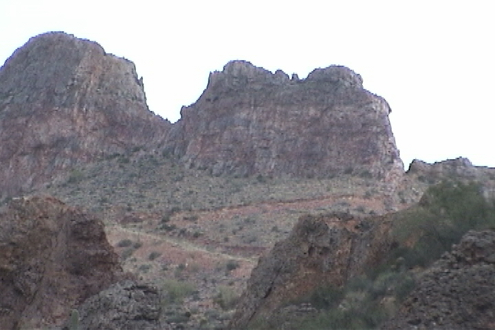
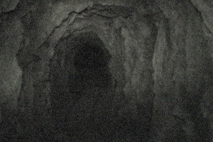
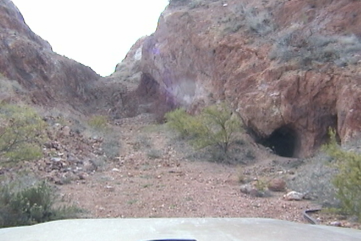
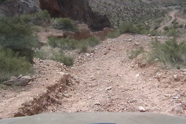
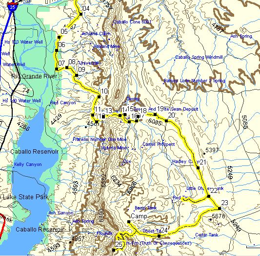
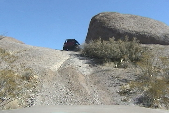
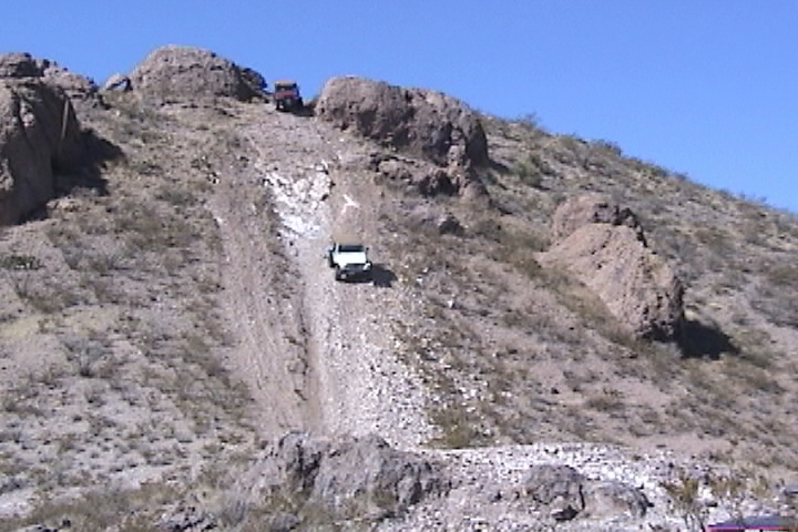
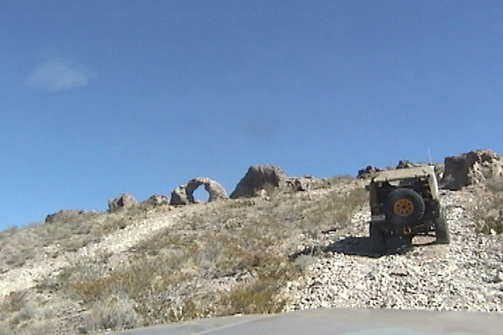
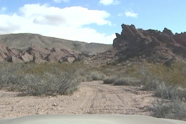
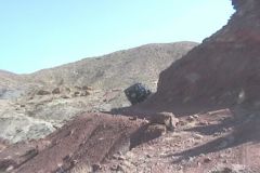
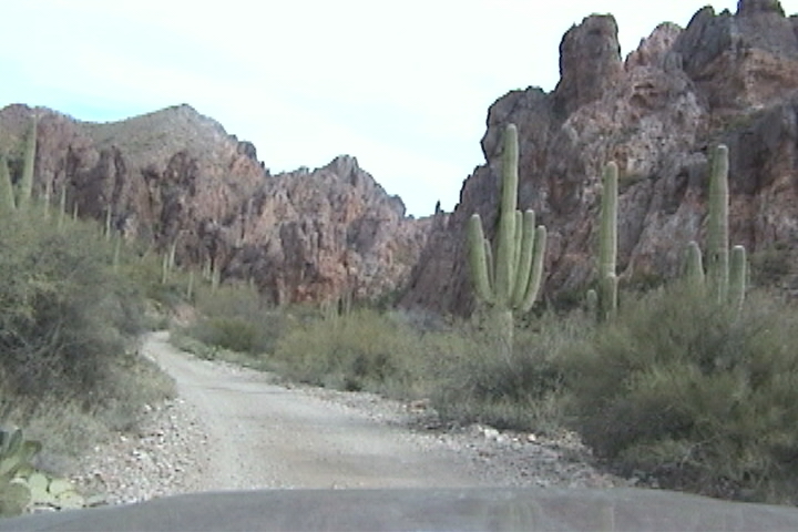
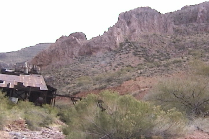
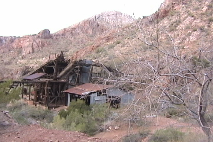
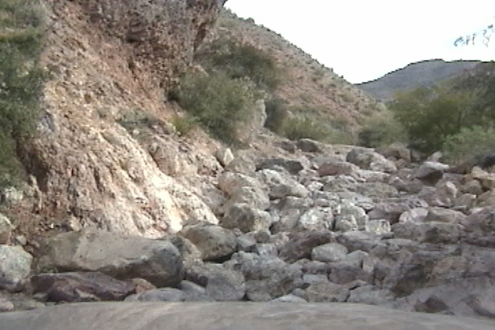
We start off to finish the trail up Martinez Canyon; I will start off where we ended our last trip when I snapped of a brake line on the bouldery wash. Just by going 50 ft. further you can see the stamping mill. (I doubt it was a stamping mill, to me a stamping mill produces a finished goods i.e. tin roofs. This could be a crusher that crushes the raw ore. There is a hopper that had rails going to it for ore buckets and a steam engine to power something that is now gone.) At the fork stay in the wash the trail goes under the rails that lead to the hopper. The right fork goes around the plant, but is washed out ahead. |
||||||||||||||||||||||||||||||||
 |
||||||||||||||||||||||||||||||||
 |
||||||||||||||||||||||||||||||||
|
Stamping plant. |
||||||||||||||||||||||||||||||||
 |
||||||||||||||||||||||||||||||||
|
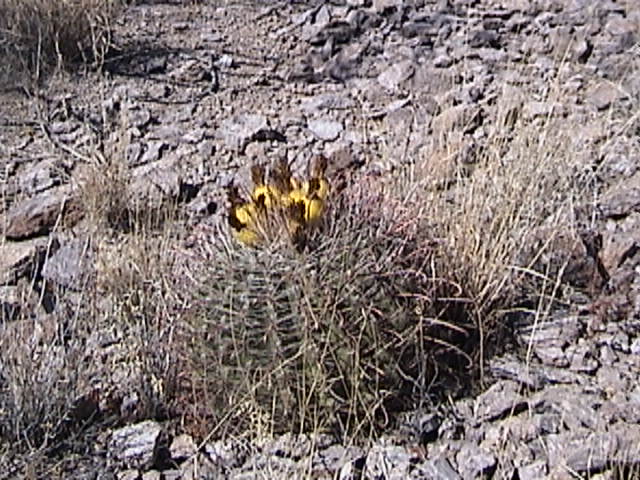
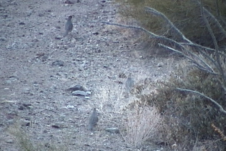
Quail |
||||||||||||||||||||||||||||||||
|
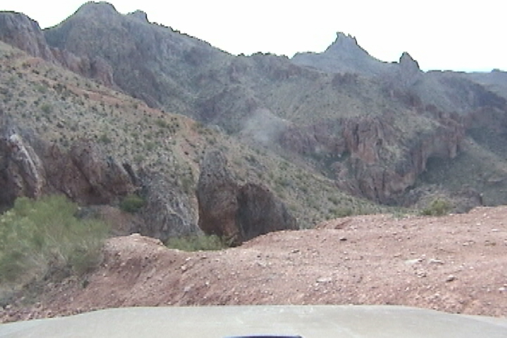
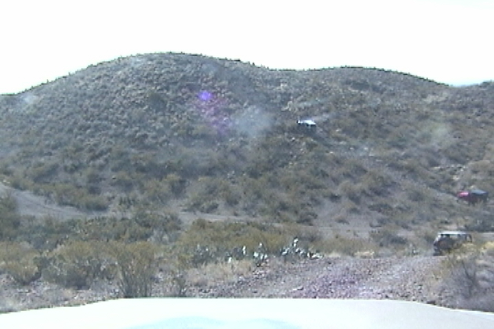
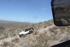
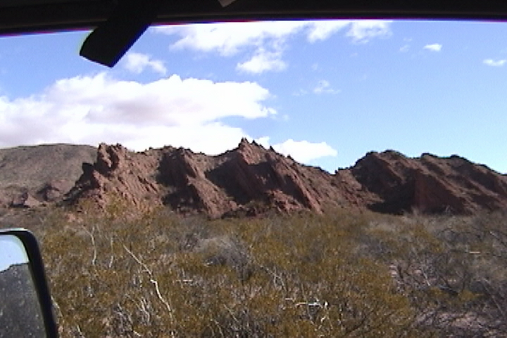
The trail leaves the wash for a short time before re-entering it and it is rough. You are definitely in a canyon with tall rock walls around you! When you do leave the wash you head up and up the switch backs, as you look around you see abandoned mines all over. You wonder how people scurried around on these steep and loose mountains. It had to be treacherous work, the mountains are a pile of sedimentary stones with fine sand and sharp broken volcanic rock thrown in. These earthen slopes piled up at the angle of repose ran right up to the vertical rock faces. If you knew where, held the promise of wealth and fortune! It had to be a thorny long way down if you slipped! You had to climb all over these mountains at the boundary of the vertical rock and earthen slope looking for telltales for gold and silver.
|
||||||||||||||||||||||||||||||||
 |
||||||||||||||||||||||||||||||||
|
|
|
||||||||||||||||||||||||||||||||||||||||||||||||||||||||||||||||||||||
|
|
||||||||||||||||||||
|
|
||||||||||||||||||||||||||||||||||||||||||||||||||||||||||||||||||||
|
In short order you are at the mining camp and headed out. Since we are headed back to Las Cruces we will go out through Box Canyon yet again and on to Florence (Again!). We will take Rt 89 to Tucson where we will pick up I 10. In Florence we stop at Burger King for a burger and I remove the front drive shaft (I still get a vibration from it) I notice that even though I had the U-joint replaced in Tennessee it is stiff. We get to I 10 with time to spare |
|
|
|
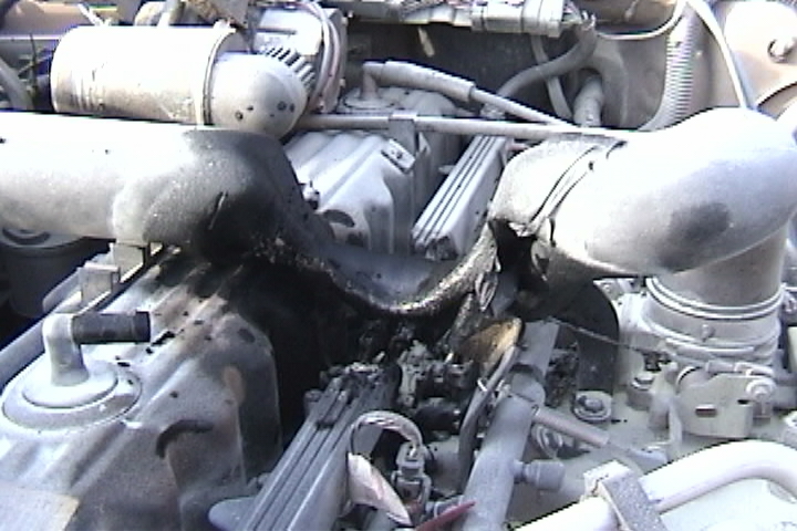
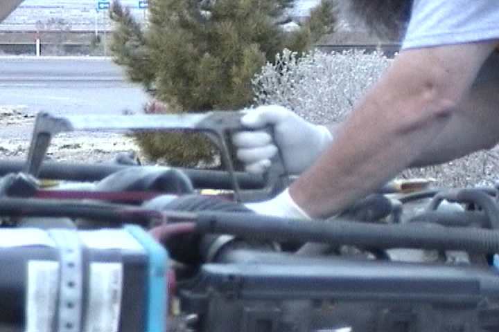
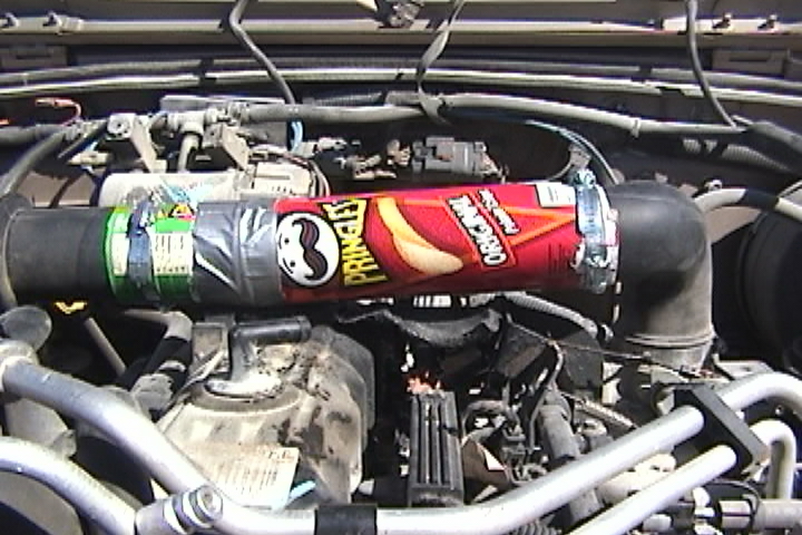
We stopped at a NM tourist information @ exit 20, Lordsburg looking for a New Mexico travel guide with town info and history (Texas has a great travel guide). I was inside talking with the attendant when he asked me Is your jeep supposed to be smoking? I looked out and it was smoking, so I ran out and cracked the hood open I saw FLAMES!! I got my extinguisher out cracked the hood and sprayed!!!! The fire was out, open the hood and survey the damage. While I was looking at it I could see glowing inside my PCV hose. So I ripped it out. As I watched, the air intake crossover tube melted and drooled over the injectors! Even though the fire was out plastic continued to melt. |
|
|
|
|
|
|
||||||||||||||||||||||||||||||||||||||||
|
Day 30 Saturday Made calls; to the New Mexico association of 4 wheelers. He gave me a place that is a jeep speciality shop Mule Barn in Las Cruces NM. And some junkyards. I called the junkyards first, one guy even laughed at me You want parts for a 2000 TJ!. Well I found none. I found a contact in El Paso. He couldnt find any parts for me either. The dealers had no parts, in fact because of the three day Presidents Day weekend, it would be Wednesday before I could get parts out of a dealer. So I ended up at the Mule Barn around 10:30 AM. Jeff looked at what I had and could not help me but he knew somebody that could, Fred Huff. Fred bought wrecked TJs and fixed them up, in fact he should be coming by any moment to pick up a part he had dropped off. (So this guy is the reason I cant find any TJs at the junkyard!). People kept coming over and being amazed at my tale of woe and that my jeep with Pringles can rans. One gentleman that came over, Lance, said, nice jeep, and wanted to know if we came here for the Chili Challenge. A Jeeping event happening next weekend. That sounds great, but right now we are waiting for Fred. He said he should be here in a moment (does everybody in this town know Fred?). Lance took us into the Mule Barn and had them print out an application for the Chili Challenge. Lance said hope to see you there, as I will be a trail leader for three days. At 12:15 Fred showed up. He came over looked at what I had and proclaimed I got everything you need to fix her up but I need the stuff for my project car I said I was hoping I could find someone with the parts as junkyards dont have them, and I was hoping to beg, barrow, steal or buy the parts. Huff said if want to come with me to the dealer and order new parts for me Ill give you what you need. Yes!! Off we went to Freds house to make sure he had the right parts.
Yup he got all the parts, off to the dealer. The dealer people where amazed, astounded, astonished got out their cameras took pictures!
$320 for the wire harness only 8 wires are burned but one injector connector is burned I was thinking out loud. We may have just the connector piped in the parts guy. 2 minutes later Yup got it $25. OK Ill take it I said. OK now for same shade and to work, Fred offers his house. I will take you up on that said I. So off to a motel to leave off Sue and over to Freds house. I got started at 3:00 it was very awkward working on the jeep, I had to hang over the middle of the motor. During one of my breaks I went into Freds garage where he was working, putting body armor on the rear quarter of his jeep. I looked at what he was making and said like a smart aleckly, You do know they make that part after market! Fred said Ya ... but nobody makes it the way I want it. Thats my problem, I said , When I buy something I have to modify it. (a soul mate!). I was finished by 6:00!! Just like new!
|
|
|
||||||||||||||||||||||||||||||||||||||||||||||||||||||||||||||||||||||||
|
|
||||||||||||||||||||||||||||||||||||||||||||||||||||
|
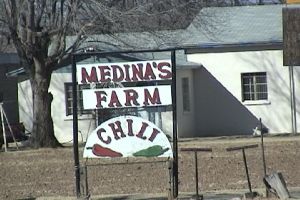
Day 33 Tuesday Got up at 7: AM back to work! The mountains to our west have snow on them this morning. Checkout time is 11:00 then back to Kinkos to upload the next installment. From T or C (Truth or Consequences) Its a 1 hour 20 minute drive from T or C to Las Cruces. We also stopped off in Hatch to buy a ristra to send to my niece. A ristra is a hanging rope of peppers. And Hatch is the Chili capital of the world 300,000 acres of Chilies! The man selling them said I needed to mist them real good because rite now they are so dry that with the slightest touch the peppers brake off, so it would never survive being shipped home. After Kinkos we find a Hotel in Las Cruces to be near the Chili Challenge Meeting area (State fair grounds exit 132 on I 10) We found BayMont an excellent value at $44.00 for two. The BayMont is at exit 140 on I 10. Now off to the fair grounds to register for the Chili Challenge found our way there and $65.00 poorer where registered ($5.00 for trail defense fund (attorneys to try to keep the trails open)). Thats it, it took all day, just for that stuff.
|
|
|
||||||||||||||||||||||||||||||||||||||||||||||||||||||||||||||||||||||||||||||||||||||||||||||||||||||||||||||||||||||||||||||||||||||||||||||||||||||||||||||||||||||||||||||||||||||||||||||||||||||||||||||||||||||||||||||||||||||||||||||||||||||||||||||||||||||||||||||||||||||||||||||||||||||||||||||||||||||||||||||||||||||||||||||||||||||||||||||||||||||||||||||||||||||||||||||||||||||||||||||||||||||||||||||||||||||||||||||||||||||||||||||||||||||||||||||||||||||||||
|
|
||||||||||||||||||||||||||||||||||||||||||||||||||||||||||||||
|
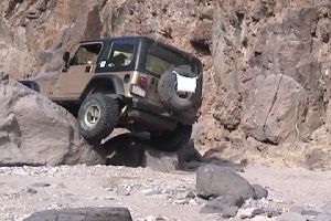
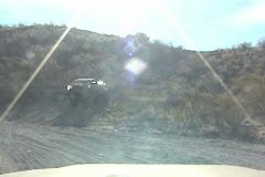
I HATE SIDE HILLS |
|||||||||||||||
 |
|||||||||||||||
|
|
|||||||||||||||
|
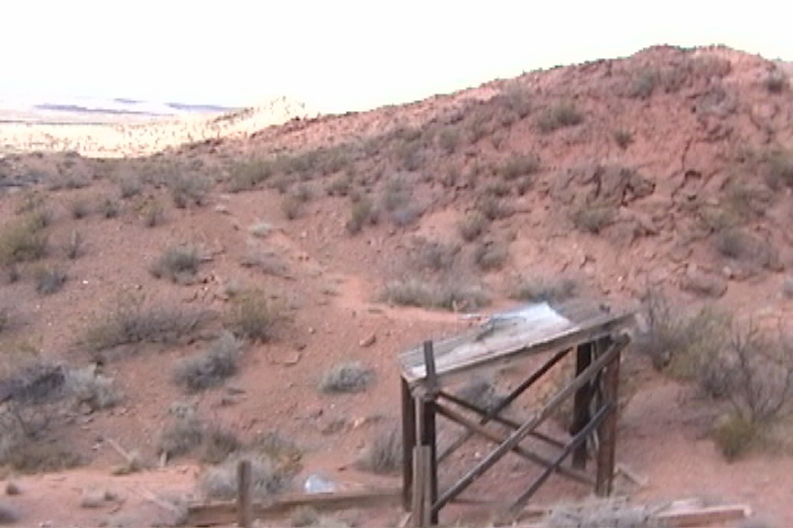
What remains of Tonuco |
|||||||||||||||
|
|
|
|
|
|
[Odyssey] [Day 8-14] [Day 15 -21] [Day 22 - 28] [Day 29 - 35] [Day 36 - 42] [Day 43 - 49] |
|
[the shaft] [airing down] [Salsa] [Air Compressor] [Cooking Meatloaf] [Articles in Low-Range] |
|
[Trails] |
|
[Choke Cherry] [Holy Cross] [Death Valley] [Chili Challenge] [Caballo Mts] [Gila NF Trip] [Titus Canyon] |
|
|
|
||||||||||||||||||||