Chili Challenge

Now for most of my trails you can download my GPS track (bread crumb trail) as well as the map of my track. For more info Click Track Info

Click on any picture with a border for a larger view

Go To Sandiego Trail

Go To Dona Ana Trail (part 1 Odyssey Day 34)

Go To Hopping Jalapeno trail

Go To Rustlers Fire Trail

Download GPS Way Points

I-25

Exit from I-25

N32 23.318 W106 48.385

Road

Head west

N32 23.442 W106 48.442

HWY28

Turn north onto RT 28

N32 23.087 W106 49.513

01

Continue strait

N32 25.631 W106 51.223

02

Turn right go under I-25

N32 26.151 W106 51.619


Is this a smart thing to do?

This is a lot narrower and has a much bigger crown than it looks in the picture!


They mined all the way up

University property line

Looking towards Trinity and victory Mt

San Diego trail map

 San Diego Trail

Continued from Odyssey day 29 - 35

Shortly after leaving Tonuco we came to an area littered with mines, the mines lined the inside of a bowl shaped valley. The valley walls appeared to have been painted by poring red, green, white, gray and brown buckets of paint down the side of the bowl. The colors came from the different minerals in the rocks. Since the road ran along the side of the hill, in many places it was narrow and tipped toward a drop off on the left of 20 to 50 feet, that's far enough to hurt. We went about halfway around the bowl and stopped the jeeps in the road( the hillside left no room to park).  From here we look back to the open end of the bowl where we entered, and beyond we see the rich green of valley farms. The green appears all the more rich for the earthen tones we are surrounded with. We then had a short walk to a mine.  The mine entrance was halfway blocked by debris that had fallen down from the hill above the mine. As we stooped over to enter the mine, our trail leader told the story of when he had entered a mine and he was not paying close attention to his footing and stepped on a rattlesnake!  Both he and the snake where extremely surprised. Other than some heart palpitations in both parties all survived relatively un-scathed.  You better believe we all paid close attention to our footing. (Going into mines is not a smart thing to do). Once inside, the shaft was level and narrow, we had to continue walking stooped over as there was not much headroom with a lot of short pointy rocks to bang your ahead on. There was a half inch of fine dust on the mine floor, along with a spattering of rocks that had fallen from the ceiling. Sections of track for the ore carts lay strewn around at unusual angles. 30 feet into the mine was a vertical shaft going down about 10 feet deep and taking up half the floor. Walking around in a mine has a lot of obstacles to trip on!  Another 20 feet ahead of us the mine was blocked by cave in (I hope we get out before there is another cave in). We carefully retrace our steps back out to the jeep's.  We continued around the bowl of the valley and exited the way we came in. We headed back towards Articulation Alley. At one point we had to climb a 10 foot berm and turned left on top, the top was so narrow my tires straddle the berm and the bottom of the jeep dragged on the top. We eventually found ourselves in a sandy wash bottom. After a short while we left the sandy wash bottom and turned left when the trail ended we parked the jeeps and went for a short hike up the ravine to view the Petroglyphs.  The rock formations in the ravine were quite colorful, now at the base of San Diego Mountain which means instead of sedimentary rock we now have volcanic rock. The colors of the rock are purple, red and green. Back down to the jeeps, we ate lunch.  With lunch out of the way we went back to the wash and headed around San Diego Mountain, so far our wanderings have taken us about three-quarters of the way around the Mountain. On the west side of the Mountain we take a left, and the trail goes between the foothills and San Diego Mt.  The trail goes past many more mines. We even drove over a mine! You can see the mine entrance below the trail and where the mine had broken the surface above the road looking like a giant rip in the surface of the earth.  We parked the jeeps and went into that mine (yet again we entered a mine, boy are we slow to learn).  This mine had a lot of debris on the floor, it was quite obvious that a lot of rock fallen down from the roof.  You could still see timbers that the minors had put up to provide a working platform so they could get at the vein as it went up.  Where they hadn't mined all the way to the surface, the ceiling collapsed so it was open to the surface now. That is the great rip that we saw from the trail.  It's 50 feet from the top of the rip to the floor we were standing on.  Ok, let’s get out before some more of the roof falls, on us!  When we get to the east side of San Diego Mt you can see the trail that goes up the face of it.  It's a steep trial and covered with loose rock and sand.  Up to this point a stock jeep would be able to do the trial.  Now I don't know your abilities so I can't tell you what you can and cannot do. However this is certainly not the place to try alone, even with lockers some of us had a hard time getting up.  Once at the top to the west we have a great view of and the Rio Grande Valley. We are in a desert so it's quite easy tell which is farmland because it's irrigated, if it's green, it's irrigated farmland.  Just about due north of you about 80 miles is the Trinity site in the white sands missile range. East southeast is Las Cruces and the Organ Mountains just East of Las Cruces, these Mountains are new as they are extremely sharp and craggy.  Just about do east of you, you can see a line that a fence makes across the desert. The University of New Mexico owns everything to the south of the line. The University is trying to close it for access so the only people that would be able to drive in would be scientists.


Looking up at  horizontal supports

This is going up San Diego Mt. It is quite steep.

Looking West at Rio Grand valley

Organ Mts behind the Dona Ana Mts just north of Las Cruces

Trail up front of San Diego Mt.

Unfortunately for San Diego Mt trail all I have are the maps and my waypoints, no bread crumb trail  Download Waypoints

Waypoint

Description

Lat

Long

01

end of ramp

N32 29.787

W106 54.050

02

turn north

N32 29.818

W106 53.963

03


N32 34.770

W106 56.038

04


N32 34.793

W106 56.724

05


N32 34.773

W106 58.229

06


N32 35.048

W106 58.465

07


N32 35.339

W106 58.713

08

Tonuco

N32 35.655

W106 58.937

09

mine

N32 35.833

W106 58.938

10


N32 35.956

W106 57.240

11


N32 36.374

W106 57.417

12


N32 36.404

W106 57.490

13

Turn rite into wash

N32 36.430

W106 57.776

14

Left out of wash

N32 36.995

W106 58.997

15

park for hike to Petroglyphs

N32 36.917

W106 59.043

16

left out of wash

N32 36.871

W106 59.715

17

turn right

N32 36.326

W106 59.021

18

turn right up mountain

N32 36.256

W106 59.022

Better view of trail map

Now as I promised the story on Dr. Voss and his golden victory Mountain.

It seems that in the late 30s a Dr. Voss came home with some gold now this gold was not the Nuggets or dust that you get from mining or panning, it was molded.  He never did say where he found it. Every now and then he would hike off into the Mountains and sometimes he would comeback with some more gold. He never came back with a lot of gold but, enough to take care of him and his wife's needs. I don't know how, but  eventually people decided that the gold was on Victory Mountain.  A lot of people tried to follow him and tried jump his claim but nobody ever did find it in. Then World War II started, the government took the land (which it was supposed to return after 20 years) for white sands missile range.  Now Dr. Voss was not real happy with this, he even got arrested several times for trespassing on the white sands missile range.  When he died lots of people tried to find his gold, the army had such a problem with people trespassing that they finally relented and allowed Dr. Voss wife two years to find the gold, which she never did.  To this day, nobody knows where the gold is. But some people think some general went and found the gold.


Hopping Jalapeno trail
Day 36 Friday     
 
For short while the trail meandered around the side of the foothills there was one spot however that proved to be a good place to check your tire pressure.  The trail has a slight camber toward the drop off (always towards the drop off) and there was a rock ledge crossing the trail at a slight angle.  Now this rock ledge was only about six inches high, if your tire pressure was low enough you just rolled right over the ledge.  However if your tire pressure is too high rather than rolling over the ledge you would bounce off it.  And because the trail was tilted it tended to throw the front of the jeep towards the side of the trail that had a long way down.  Now most of us had no problem with this, however there were a few jeeps that had aired down to 18 P.S.I. and they had considerable trouble "I don't have lockers" they would say. (I have noticed that people that don't know how to drive will manage to blame it on their equipment).  Shortly we turned left into a very shallow wash.  With the normal desert plant life of Yucca, desert grass and cholla there's no forest to block your view and there are great vistas to be had.  The rock around here seems to break apart in cubes, as a result the trip down consists of mainly going down stair steps, since this is a wash there's also sand, gravel, stones and bigger stones.  Eventually we end up in the same wash where we had watched the big boys play although further up the wash.  No sooner than entering the wash we turned left and started up another wash, the way back out. At one point we were in the wash on a flat rock that was tipped to the left, if you look at the picture you can see Fred and just in front of the hood on the left you can see a square rock.  Now Fred was trying to tell me to go around the rock, but I knew better!  If I went over the rock at least for the moment when the jeep's tire was on top of the rock the jeep would be level (I hate side angles).  I found the rock with my left front tire and as I started to climb it a great whooshing sound was heard my navigator yelled out "O no".  Well that will teach me for not doing what my spotter tells me, because my left front tire went flat!  After getting out and surveying the damage it was decided that I popped the bead.  Now you have two choices, you can put the spare on, or try to reseat of the bead.  We opted for trying to reseat the bead first.  The only way to reseat the bead is to take the weight of the jeep off of the tire and pump it full of air.  Which means jacking the left front of the jeep up, now remember I'm sitting on that tilted rock something has to be done to stabilize the jeep when I jack it up. We decided to use my winch and attach it to another jeep to stabilize me. When I went to use my winch it did not work!! That’s not good! Fred brings his jeep over to the right side of mine and we run a his winch cable over to my tow hook on the front of my jeep this will prevent my jeep from sliding downhill and falling off the jack.  I use my OEM jack under the axle and fill the tire with air. Lowered the jeep down off of the jack and the away we go. Tonight the local jeep club is hosting a cook out at the Fairgrounds, but first a quick trip to the hotel to freshen up.  Now my steering wheel has never been straight but it seems to be even more crooked than usual.  When we get into Las Cruces and start doing left and right turns on city streets I noticed that there are times when the steering wheel seems to be almost straight!  Now I don't like it when something in my steering changes that usually means something is bent or broken.  I gave a look and wiggle to all the steering and front suspension components, and could find nothing wrong.  So on to the next problem, my winch.  I take the cover off of the winch relays. After looking very closely I see that a bus bar is broken right where it attaches to the relay. Well I don’t have any copper to make a bus bar.  I don’t like not having a winch and doing trails. However tomorrow we are doing an easy trail.   So I put the cover back on the relays and after freshening up we headed back to the Fairgrounds for dinner.  At the arena entrance where I was standing in the chow line, I noticed a utility trailer that was all set up for doing welding.  Along with every kind of make, model and modified vehicle.  They had a pretty good system for the chow line they had a double sided table where you could make your own hamburger, hot dog and load up with ranch beans, potato salad, chips and a tossed salad.  On a separate table was the deserts, cookies, cakes and fudge.  The cook was outside in a separate trailer and they shuffled the food in by the tray.  I think they said that they fed 300 people. After eating and socializing for a while we headed back to our hotel.  On the highway I decided something was definitely wrong with my steering.  For if I gave a quick jerk to the left and then drove in a straight line the steering wheel is almost straight.  If however I gave a quick jerk to the right and then went straight the steering wheel was very crooked indeed! In the hotel I got out my flashlight and had Sue wiggle the steering wheel.  I was very glad when I found the problem!  For left unattended it would certainly have led to a serious accident!  The track bar keeps the front axle located in the center of the jeep, one end bolts to the frame of the jeep and the other end bolts to the axle.  While the end bolting to the frame actually bolts to a bracket that is welded to the frame, the weld was broken for two-thirds of the way around!  So I carefully drove back to the arena found the trailer with the welding equipment and $35 later had a steering wheel that while still crooked at least stayed crooked.
This was a fine little trail, short and not particularly scenic, while stock jeep's should be able to do it you will bang your gas tank going down off of the steps (that is what the gas tank skid is for).

Yes, Fred is standing up! and yes that is the rock that popped my bead!

Map of trail

Download track of Hopping Jalapeno trail

1

From Rt 70 turn north onto Shalem Colony Tr

N32.30703 W106.83958

2

go 4.9 miles turn left into gavel Co.

N32.37365 W106.85644

2a

left to overlook right to trail

N32.37093 W106.87270

2b

canyon overlook

N32.36857 W106.87322

3

left

N32.37949 W106.89060

4

left into wash

N32.38102 W106.89894

5

left up wash

N32.37164 W106.89857

6

right to exit

N32.37993 W106.89610


Rustlers Fire Trail 

Flat Flat Flat

Our destination is beyond those hills

This is desert!

Abandoned corral

Cows!?

Views from top

These cacti are growing out of a rock face!

This bush is on the tippy top

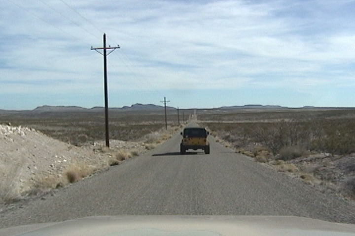
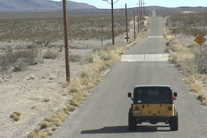
  Airing down shortly after leaving graded road I aired down, I said I aired  down the because the ride is so much smooooother. Two of the three members of the group aired down to 16 P.S.I,  19 P.S.I respectivly and one gentleman didn't air down at all, "I aired down once and it made no difference, besides I don't have an air compressor to air back up ".   "I have on board air you are welcome to" I said, I asked him how far down he had aired down to?  He said "I aired all the way down to 17 P.S.I".  I said you're right at 17 P.S.I. you won't notice any difference, with those tires you'll need to go down to about 13 P.S.I before airing down will become effective.  "Well I'm not going that low".  I did get Rosie and Paul to air down to 15.  So off we went.  Once you leave the graded road the trail gets pretty rough, not rough as in rock crawling but rough as in lots of plum  sized rocks.  With properly aired down tires even with this kind of surface you get a smooooooooth ride.

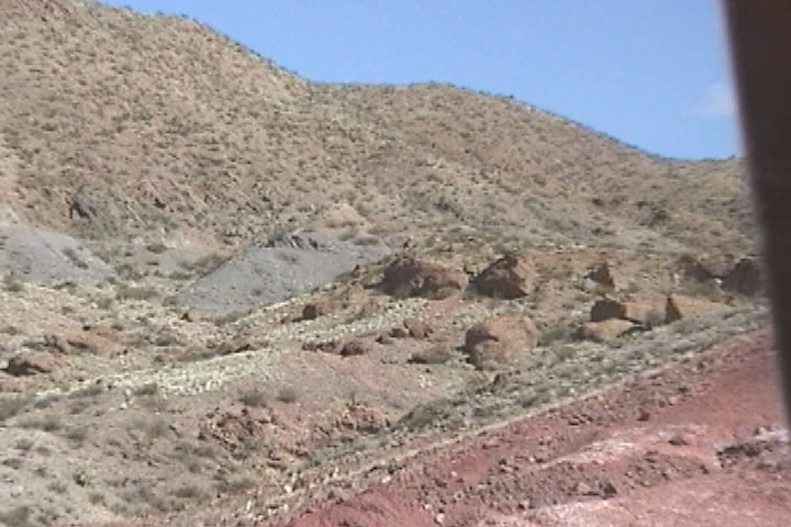
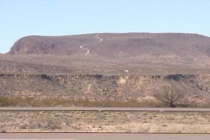
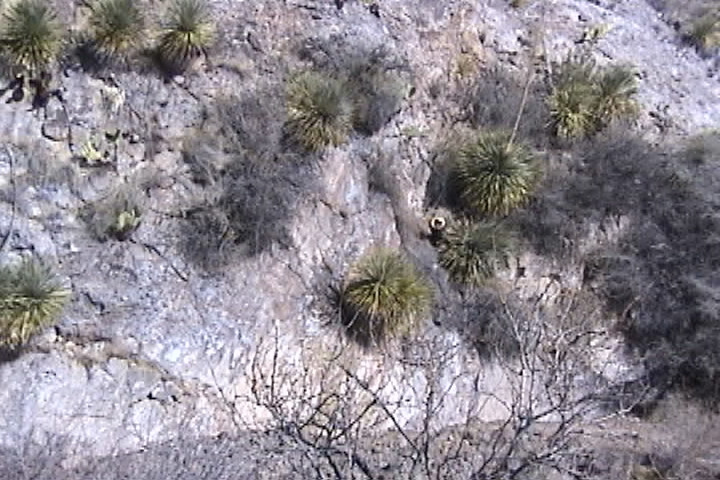
  This is a desert!  Whenever you think of the classic desert you think of miles and miles of sand with no vegetation.  There is grass here but it's very brown and dry and very sparse.  It reminds me of a man's head with very very thin hair.  There are some cacti probably the least amount of cacti yet.   This area has hard packed (not sand its even finer than sand) powder, with lots of rocks mixed in.  Round smooth rocks sharp jagged fractured rocks. Rocks of all kinds and sizes, from a small car down to talcum powder.  When the powder gets wet and then is baked by the sun the whole conglomeration gets almost as hard as concrete.  Digging by hand is quite difficult. 

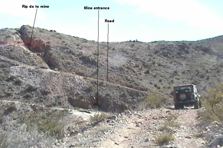
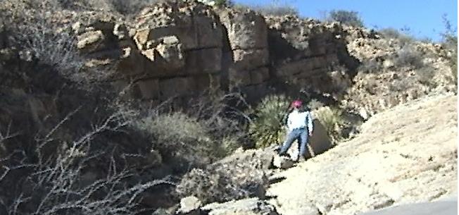
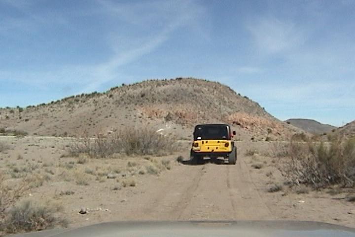
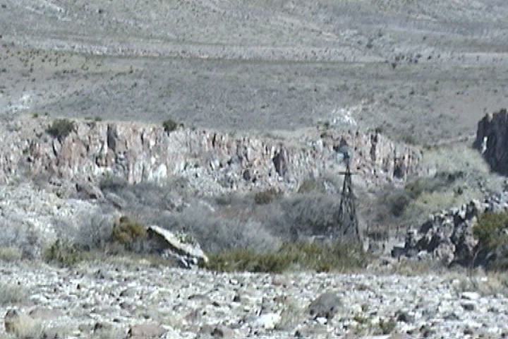
   As we go along the trail the hills get a little higher, the washes get a little wider and a little deeper and a little rougher.  Off to the right in a wash bottom you can see the remains of a corral and a wind driven water pump.  We did not go down and check it out, but from here it certainly looked abandoned and in disrepair.

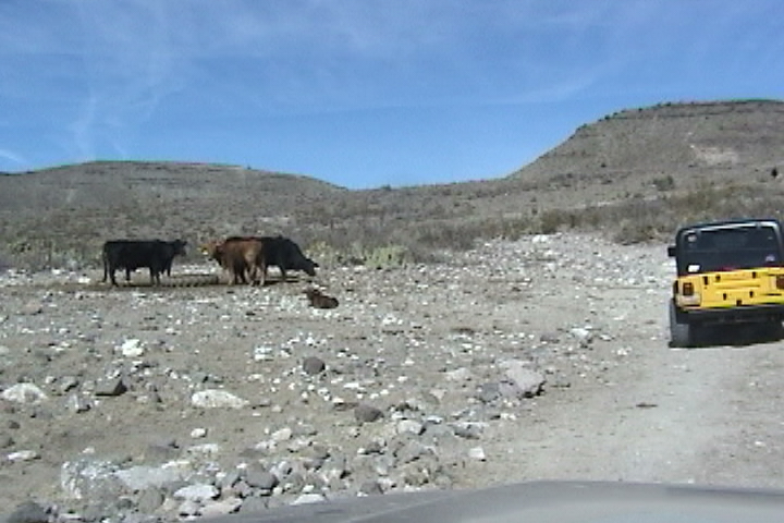
  A mile or so farther down the trail we come across some cows!!  What are they doing it out here! I can't imagine how a cow could survive out here let alone grow.  This area is prime cattle grazing land.  Do you remember five or six years ago the media having a field day because the BLM was "practically giving the land away" when they leased it to ranchers.  Well this is the land.

 
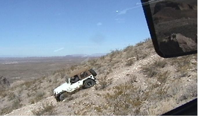
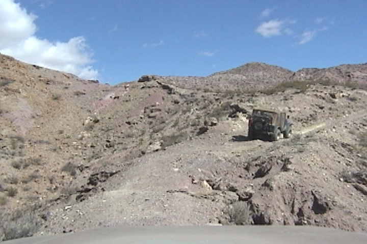
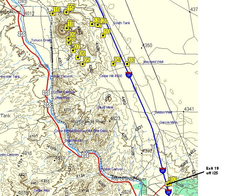
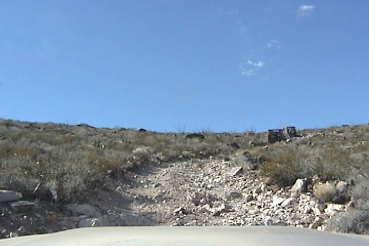
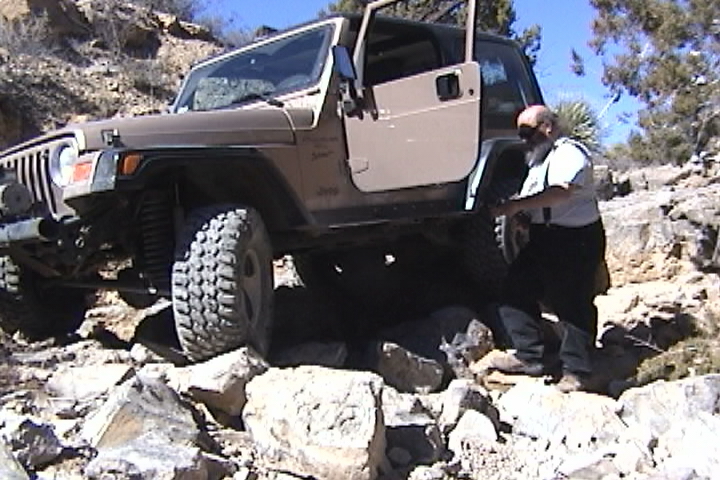
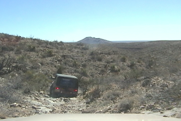
  The trail finally headed up the side of one of the small hills.  Rosie got on the CB and suggested that if we didn't have lockers a little speed was necessary as the trail was very loose.  With my 11 P.S.I  I just walked right uphill without using my lockers after we all got to the top (which took a  while and as the gentleman that didn't air down at all, had to make three attempts to get uphill.  I again offered to air him up at the end of the  trail if he wanted to air down.  He declined again. However Paul took me up on the offer, I got Paul down to 12 P.S.I.

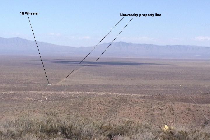
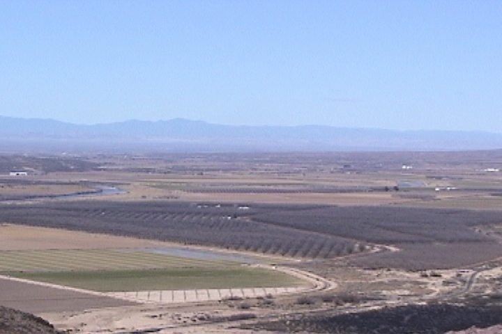
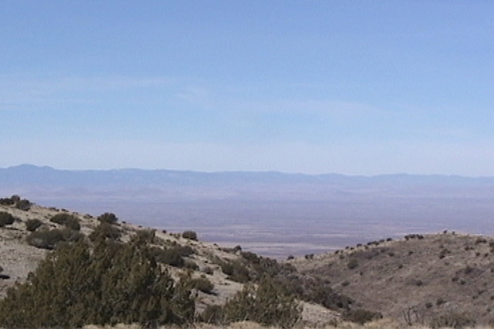
  We were no longer in the flats, our up hills are longer and our down hills were shorter.  And just about lunchtime we crested a very large domed hill, Rosie announced lunchtime!  While we ate lunch and enjoyed the views we chatted about where were from and trails we have done. Rosie came over and said "taking out those 3 P.S.I made a big difference".  I agree, you won't notice much difference from airing down until you can see a good bulge develop in the side of the tire. 15 to 12 P.S.I  is not much but it's the important 3  P.S.I much more important than from 32 to 17 P.S.I.

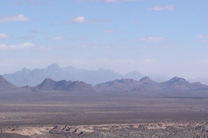
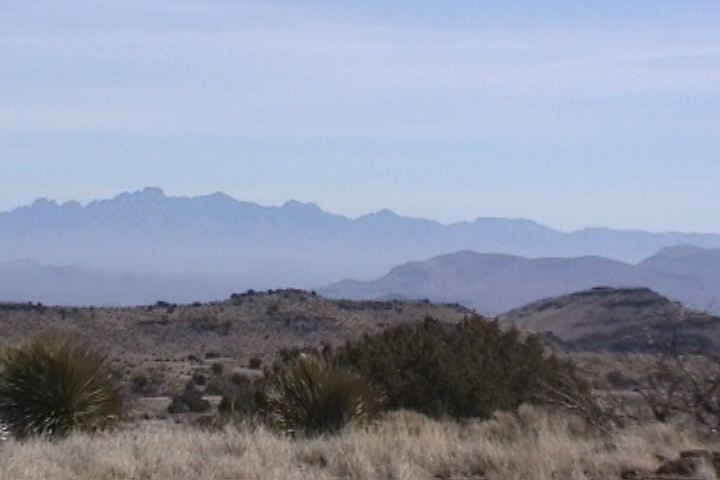
  The views from up here (6,102 Ft) were pretty good the wind had been blowing (as usual) so the air was full of dust and hazy.  All around us you can see smaller foothills surrounded by flat valleys no matter which direction you look in, on the other side of the valley off in the distance BOING!! a mountain!

After lunch we mounted up and started the trip home. When we got back to the graded road I aired the three of us back up (remember one gentleman wouldn't air down).  We were back on pavement at 2:30 so we headed back to the hotel. Then a quick shower and we head up to the arena for Saturday night's festivities, dinner and a raffle!

Man made gotchyou’s! Concrete dips for water

Down load GPS track of Rustlers Fire Trail

GPS Track info

GPS for Rustlers Fire Trail

01

frontage rd from air port

N32 16.425 W106 55.318

02

Rt turn

N32 15.943 W106 58.924

04

left

N32 18.164 W106 59.814

05

right

N32 18.261 W107 00.173

06

left

N32 21.325 W106 59.308

07

right at fork

N32 22.273 W107 02.240

08

right, leave graded road

N32 30.151 W107 08.912

09

left

N32 30.147 W107 08.832

10

left out of wash

N32 31.722 W107 08.559

11


N32 31.750 W107 08.955

12

right

N32 31.980 W107 09.429

13

lunch with view turn around

N32 34.104 W107 10.700

14

strait

N32 31.459 W107 09.667

15

left onto graded road

N32 30.324 W107 09.634

Click on for a blow up of Rustlers Fire Trail

Click on for a blow up of      access to Rustlers Fire Trail


[Welcome page]

The Odyssey

[Video, Jeeping 101]

[GPS Track info.]

[Links]

[Odyssey] [Day 8-14] [Day 15 -21] [Day 22 - 28] [Day 29 - 35] [Day 36 - 42] [Day 43 - 49]

[City Match Name] [Name the Folige]

Articlescles

[the shaft] [airing down] [Salsa] [Air Compressor] [Cooking Meatloaf] [Articles in Low-Range]

[City Answers] [Foliage Answers]

[Trails]

[Choke Cherry] [Holy Cross] [Death Valley] [Chili Challenge] [Caballo Mts] [Gila NF Trip] [Titus Canyon]

[Woodpecker Mine]  [Picket Post]  [Box Canyon]

E-mail chris@seetheusabyjeep.com

E-mail Support@seetheusabyjeep.com