Death Valley Titus Canyon

Now for most of my trails you can download my GPS track (bread crumb trail) as well as the map of my track. For more info Click Track Info

 
Today we explore Titus Canyon.
 
Last night low 60 degrees                                          Way Point = WP
Had an interesting day!
I am sitting in Echo Canyon writing this (see photo).
 
   Spent last night at Stagecoach Motel and casino, in Beatty, Nevada only $43.00 with tax!
Fridge two queen beds desk, $0.25 / phone call.  In the casino, was up by $2.20 but lost it. Nevada gambling total so far is - $43. (Big Spender)

Click on any picture with a border for a larger view

Echo Canyon Office of seetheusabyjeep.com

The road through Titus Canyon is one way into Death Valley, and this is why; the road is narrow with switchbacks on a steep hillside. While there are places to pass it would require someone to back up, and if neither party is good at backing up a narrow switchbacks road for ½ mile…. You got a problem! And then there is the “canyon” it is very narrow and extremely windy and windy (is that windy and windy or windy and windy....who says English ain’t stupid).

Road on the NV side.

 9:30 Called the Ranger to see if Titus Canyon was open? Chris (the ranger on the other end of the phone) said “Yes, it’s open”.  Jeeper Chris explained “I tried to go through yesterday and it was closed.” “Oh” ranger Chris said “hold on a moment.” I could hear him talking to another ranger on a radio I could only hear parts of the conversations. Ranger Chris came back on the phone and said “I just spoke to a ranger and he says the gate is open.” “Great, thanks,” Jeeper Chris said.  Just as I was about to hang up I heard him yell Hold on! I did, there was a flurry of radio talk. As soon as ranger Chris got off the radio with one ranger I could hear another call him.  After about 5 minutes Ranger Chris came back on the line and said “Boy that got the radio hopping, some say it’s open others say it’s closed but I believe the guy that admitted closing the gate.  So I’d say it’s closed.  Where are you?” I said “Beatty NV, 4 miles away from the gate.” Ranger Chris said, “give us an hour to open the gate up.” “OK” Jeeper Chris said.


Yesterday afternoon

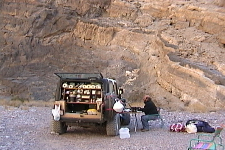
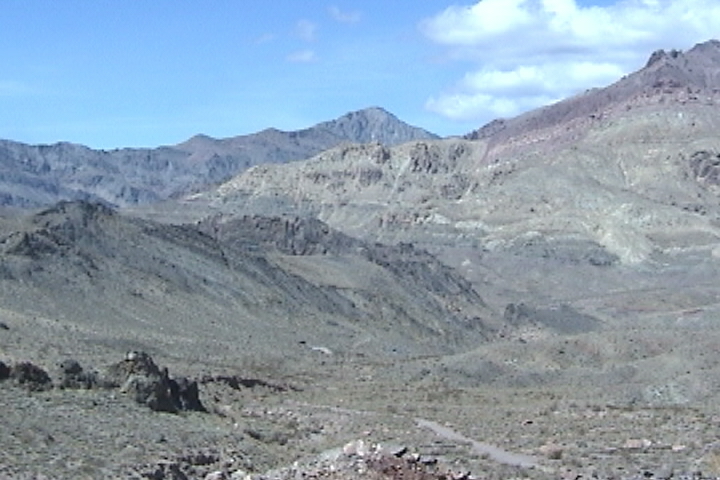
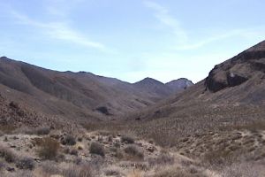
From this side the hills are all rounded with an occasional out (or up) cropping of rock. Back East we don’t have this type of hill construction, we have soil with rocks big rocks, little rocks, erosion has made our rocks mostly smooth.  When our soil gets wet it turns to mud and mud has very little traction.  Out here however, the hills are made of fractured rocks mixed with sand. Your rocks while mostly small (now don’t go Texas on me you do have large ones too).  Most of your rock have not been eroded smooth yet.  Also your rocks are made of different stuff, they have traction! I can climb both by foot and by jeep over obstacles that back east would be impossible to climb. The rock out here is rough like slick rock (sand stone). Now you do have some stuff (nasty stuff) out here that we don’t have, I don’t know the name of it but when it gets wet, it’s slipperier than snot!  No joke it’s slipperier than the ice we get on our roads back East!!!

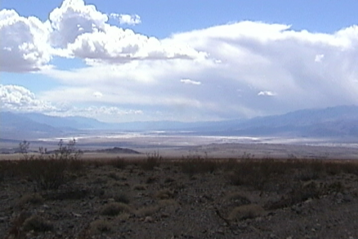
 Other than greasewood (creosote bush) and some sparse grass there is not much vegetation.


So off for breakfast we went.  The service was so very slow at the Stagecoach, we left and ended up at the Exchange Club Casino + Restaurant down the street.  The people were friendly the place was clean, service fast, prices good, food really good!

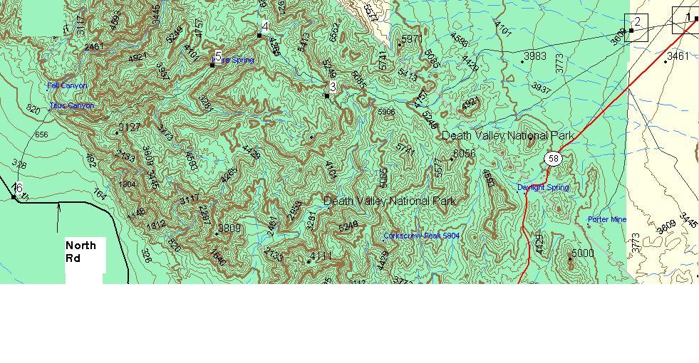
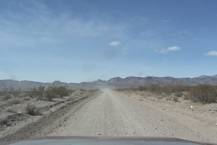
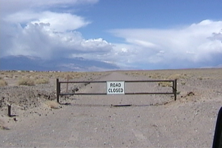
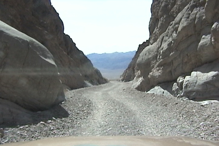
 11.00 AM off again to run Titus Canyon. The road actually starts in NV and heads NE. The road is a rather bad washboard!  Fortunately I had not aired up from yesterday’s attempt at Titus Canyon.  In about 1.8 miles you come to the park gate (if you are at the gate hopefully its open, for getting correct info from a park employee is tough) as soon as you cross the gate your in CA and the road gets narrower and rutty.  Shortly you transition from flaaaaaat to a slight up grade.  We could see dust from a vehicle up ahead of us, wondering if it was the ranger who opened up the gate? 

 Up-up-up not steep but constant. We catch up to two cars (did I mention, the rangers say “4 wheel drive only road?” well it’s not so far) When the road gets into the foothills it is in better shape, a little wider and not as rutty.


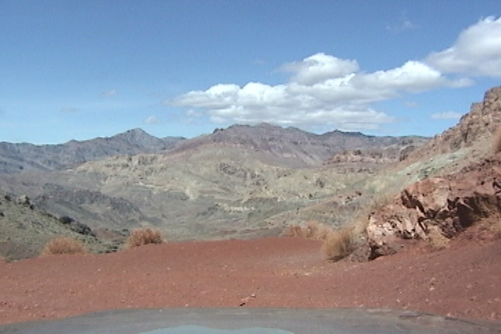
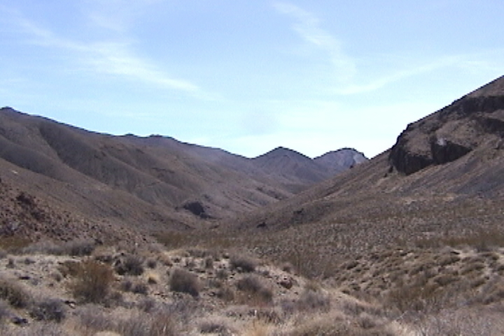
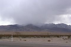
East side of foot hills

Then it happens, as so often out west you go around a corner and BAMM ----- another ?@#>*&< scenic vista!! So get out the camera. Laid out before you is a bowl made of mountains with their insides exposed.  You can see the ribs and the different colors of their jagged insides muted reds, browns, whites and yellows!  Off to your west in between a pair of peaks you can see Death Valley itself. 


Now you start down (remember the road in Death Valley is -200 ft. and we are now at 5261 ft. (for those of you with GPSs that is WP 491), so we got a long way to go! Shortly after starting down the switch backs into the exposed bowels of the hills, the road runs into some dry snot! (thank god its dry) I suspect that is why they closed the road yesterday “the road got wet” is all the park employee knew.  The western sides of the hills are much more jagged and eroded with a lot less vegetation.  If the hill is made of fractured volcanic rock you will find barrel cacti on the hill side.  The barrel cacti don’t seem to like the hills with soil, They seem to prefer jagged fractured volcanic rock cliffs!  Oh, did I mention the petroglyphs WP 493. The road is good, so good in fact that I got 3 cars behind me! The road is gentle in its slope but un-relenting.  Around each corner is a hillside of sand and rock or steep exposed jagged innards.  You continue down until you enter a wash, this is the start of Titus Canyon. There is also a mine here (there are mines all over the place so that doesn’t help to distinguish it). Now that we are in the wash we follow it down (I am left wondering how and why the washes have such an incline to them and are not washed out.) The washes are smoother than you would expect for such an incline.  You go from 3037 ft to 984 ft in about 7.5 miles never very steep but constant and never a wash out. Titus canyon is a canyon in the truest sense of the word, in places the walls are right up to you, I would not like to drive a full sized down through it (people do quite often) even some overhangs! And very curvy!  The bottom 6 or 7 ft of the canyon wall is worn smooth from erosion both water and sand blasted from wind.  When the canyon ends it ends abruptly no subtlety wasted there… BOOM you’re out on alluvial fan with Death Valley laid out before you. (An alluvial fan is what is made when debris washes out of canyons if you see one from a distance it looks like a fan). You still have 1,000 ft to come down in 2.7 miles on a graded road to pavement.

All in all you can get your Volvo down this road (and several people behind me did) but it is still worth the trip!

Map of Titus Canyon Death Valley CA

Death Valley Valley

Titus Canyon, Death Valley

Down load WayPoints for Titus Canyon

Directions

WP

LAT

LONG

Turn right onto dirt

1

N36 51.607

W116 50.706

NP + CA Boundary

2

N36 51.309

W116 52.699

5261 ft pass

3

N36 49.727

W117 01.949


4

N36 51.191

W117 04.014

Petroglyphs

5

N36 50.472

W117 05.439

Pavement

6

N36 47.254

W117 11.490


[Welcome page]

The Odyssey

[Video, Jeeping 101]

[GPS Track info.]

[Links]

[Odyssey] [Day 8-14] [Day 15 -21] [Day 22 - 28] [Day 29 - 35] [Day 36 - 42] [Day 43 - 49]

[City Match Name] [Name the Folige]

Articlescles

[the shaft] [airing down] [Salsa] [Air Compressor] [Cooking Meatloaf] [Articles in Low-Range]

[City Answers] [Foliage Answers]

[Trails]

[Choke Cherry] [Holy Cross] [Death Valley] [Chili Challenge] [Caballo Mts] [Gila NF Trip] [Titus Canyon]

[Woodpecker Mine]  [Picket Post]  [Box Canyon]

E-mail chris@seetheusabyjeep.com

E-mail Support@seetheusabyjeep.com